Browsing Tag

Olympic Peninsula

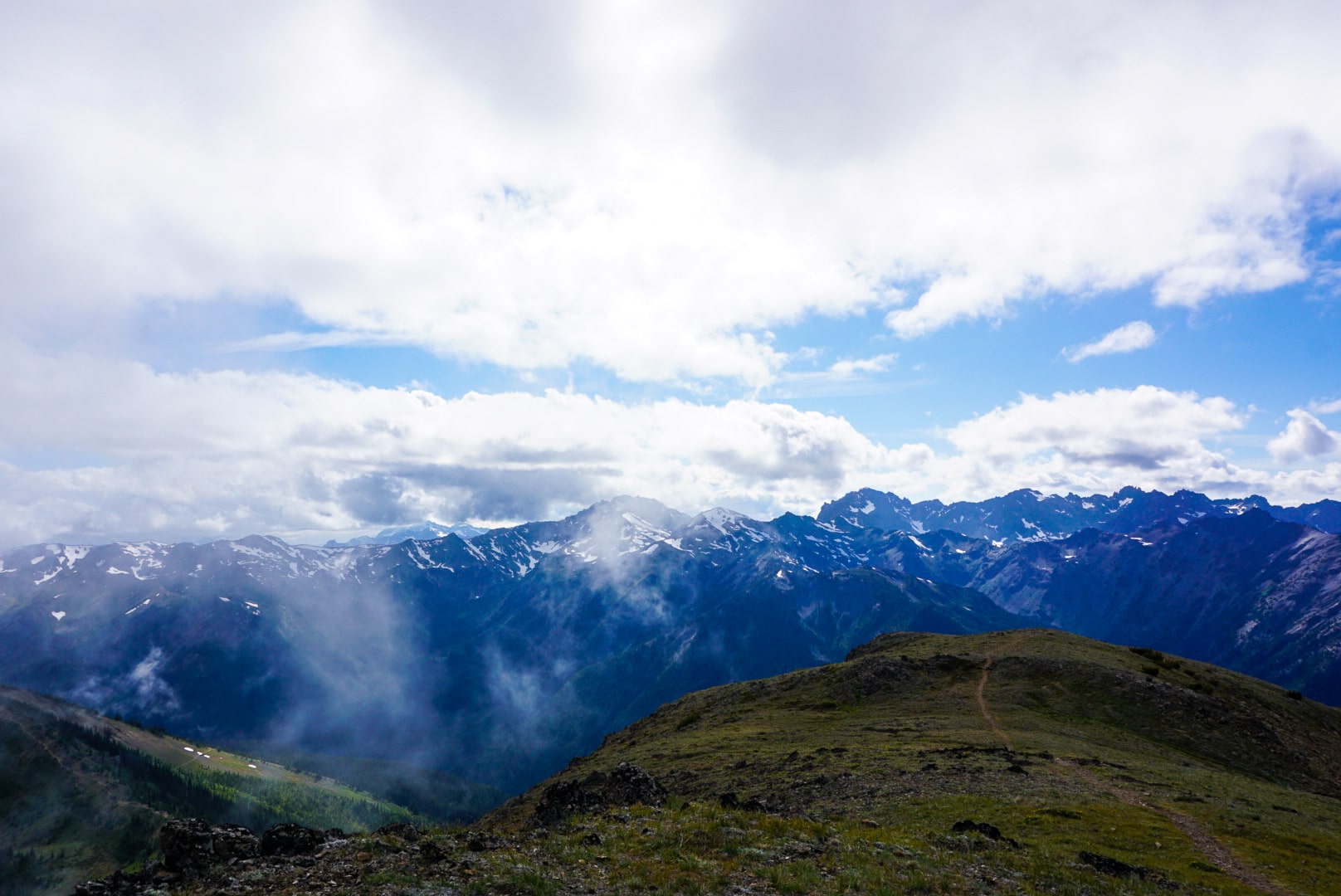
Shi Shi beach is a special Pacific Northwest beach. From looming sea stacks to moody skies you will have the full Washington coast beach camping experience. This hike can suit anyone from the beginner backpacker trying out their overnight pack for the first time to the well seasoned veteran looking for remoteness and ocean energy. With minimal cell reception, a cool sea breeze and an open coastline you will be sure to find peace and quiet at Shi Shi.

photo by Ashley Greenwood
Sea Stacks at Shi Shi Beach.

Things to know about beach camping

Beach camping is unique in that you will be sure to get sand in everything, everywhere… and somehow all of your belongings will end up damp by the end of the trip. That being said, make sure to pack quick dry clothing, warm, wind-breaking layers and a tide chart. It is important to be aware of the tides as well as safe spaces to set up camp to avoid getting in a dangerous situation (e.g. waves crashing in on your tent in the middle of the night) due to a miscalculated high tide. See Washington’s tide chart for the Shi Shi beach area here

It is possible to have a campfire on the beach as long as there is not a burn ban in effect. The only catch: drift wood is the only option for you, which means no foraging in the woods bordering the beach for downed branches.

Trail description

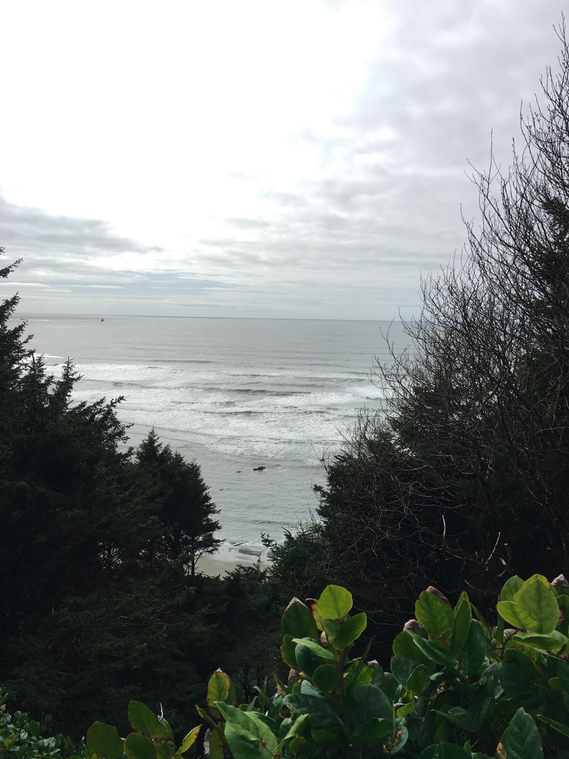
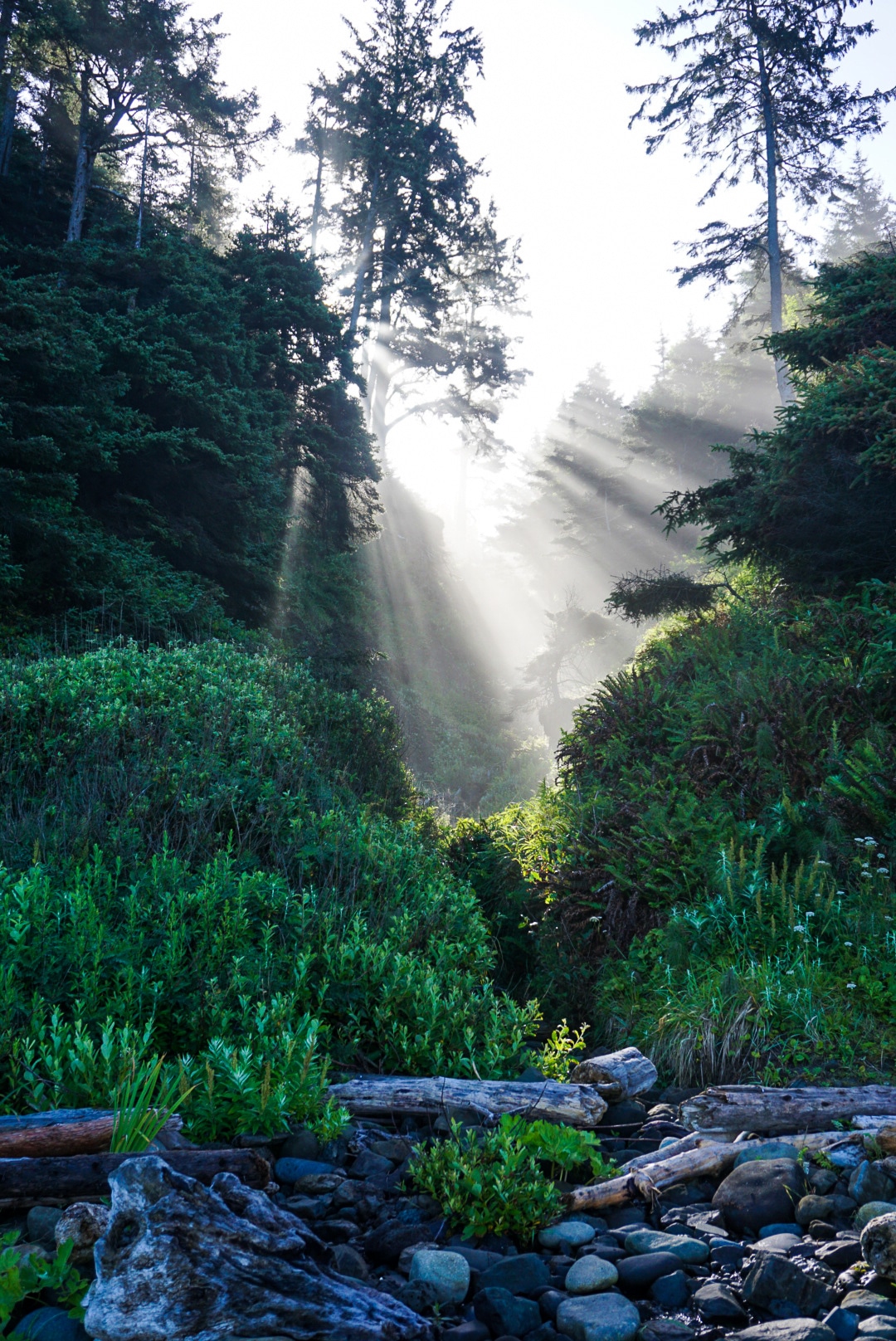
The hike into Shi Shi to your campsite can be as little as 2.5 miles or as long as 5 miles depending on where you decide to settle in for the night (.5 of those miles comes from the beginning walk to the trailhead from the nearest parking lot). The trail itself is a fairly flat 2 miles from the actual trailhead down to where you are spit out onto the beach. The first half of the hike is a pleasant stroll on a series of elevated boardwalks and wooden bridges inside a dense, old growth forest. The second half of the hike opens up into a newer growth forest with a wide, perpetually muddy trail. Be sure to wear shoes that you are comfortable getting very dirty. Once you have finished stomping through the mud, you are rewarded with your first glance at the Pacific Ocean. Minutes later, you will come to a set of steep stairs bringing you down to the beach. Once at the bottom you are free to continue south to choose a campsite either tucked in the shaded woods or exposed to the elements of the beach. Both are great options!

photo by Ashley Greenwood
Beach views of the Pacific Ocean from the Olympic Peninsula.

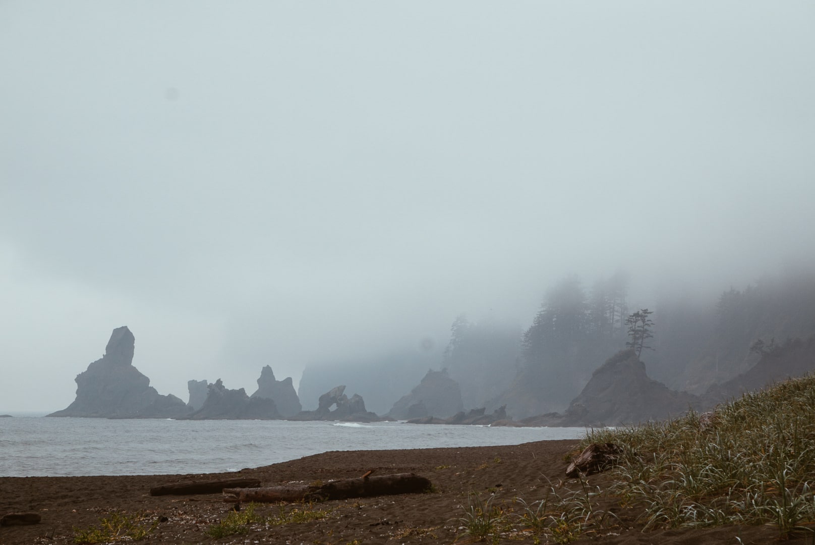
If you continue hiking on the beach you will come across Petroleum Creek, ironically a great resource for drinkable water, just be sure to filter/boil it. This is about 1.3 miles from the bottom of the stairs. Continue another mile and you will find yourself at the astounding Point of Arches – one of the many gems of the Pacific Northwest. This grouping of sea stacks will be sure to stop you in your tracks as you look up to these peaceful giants surrounded by crashing waves.
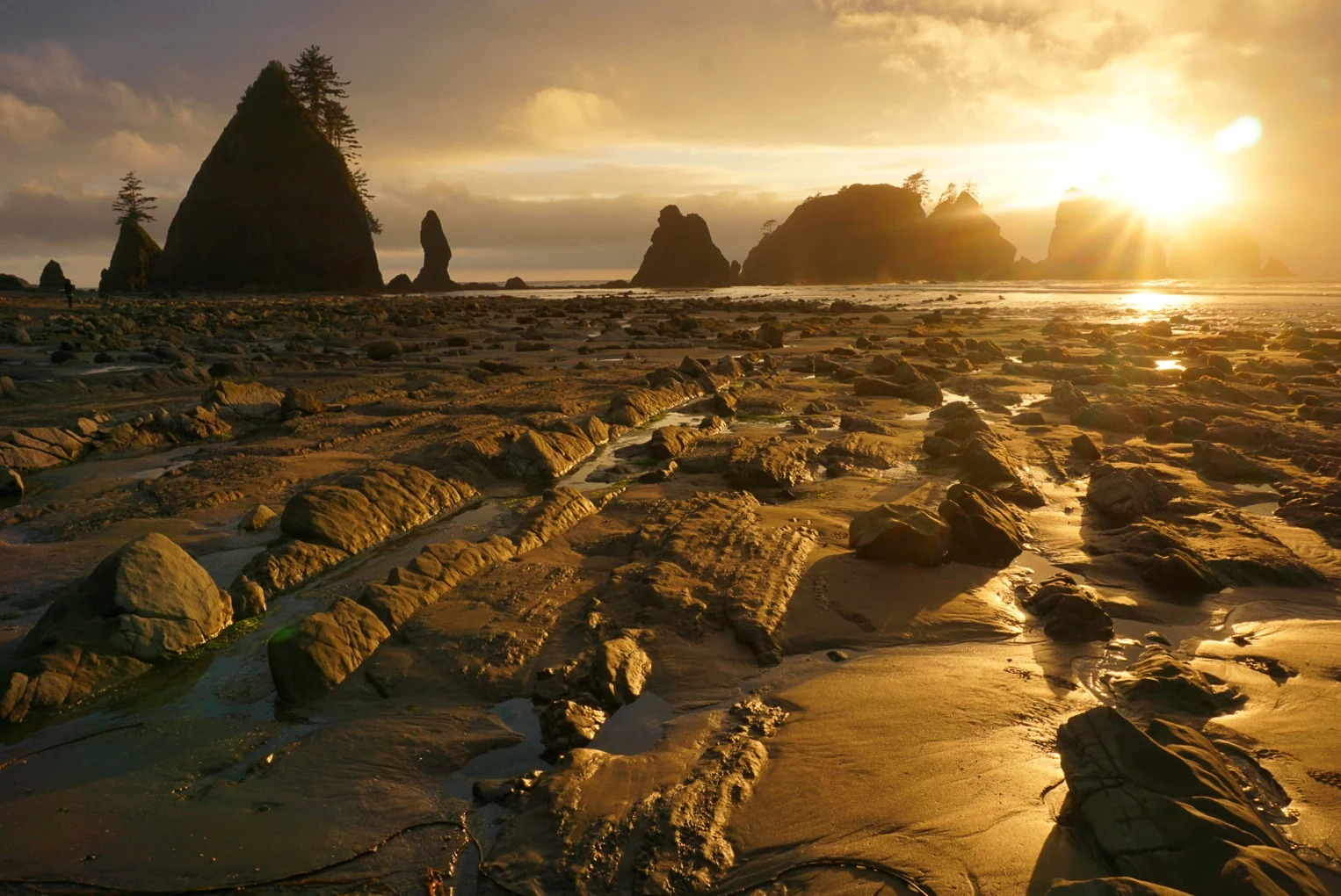
Point of Arches

The Point of Arches is a breathtaking sight, even better during sunset. While at Shi Shi beach be sure to take a walk to see the giant sea stacks, perhaps after shedding the backpack and setting up camp for the night. If tide pools or photography are interests of yours, the Point of Arches will not disappoint. While visiting and exploring this part of the beach take caution and be sure to double check the tide charts to ensure that you can safely get back to your campsite. See Washington’s tide chart for the Shi Shi beach area here

Point of Arches.

Wildlife

Shi Shi beach is full of wildlife. Take a walk to the tide pools to explore the marine ecosystems or continue a walk down either direction on the beach. Look up at the sky and you are likely to see eagles, herons and sea birds. Sea otters, coyotes and seals are also known to frequent Shi Shi beach. If you are lucky you may even have the opportunity to spot migrating whales, so keep an eye out.  

The wildlife at Shi Shi is very fun, but it is still wild. Be sure to keep a safe distance! A bear canister is required and can be rented from the Olympic National Park Visitor Center. While a bear encounter may be extremely unlikely, you may find yourself defending your food against other critters like deer, coyotes, eagles and raccoons.

photo by Ashley Greenwood
Morning rays at Shi Shi Beach.

Parking logistics & necessary passes

When visiting Shi Shi beach you will be required to have two different passes. 

The first pass you will need is an Olympic Park wilderness permit from the National Parks Service. This can be purchased with your bear canister at the Olympic National Park Visitor Center in Port Angeles or Forks.

The second pass you will need is the Makah Recreation Pass. This can be purchased for $10 at the Neah Bay General Store, the Mini Mart, Marina or Museum. 

Once you have both passes you will need to find a space to park. The trailhead does not allow for overnight parking so take this into account as you head towards your final destination. On the way to the trailhead there will be a few private properties that allow backpackers to park for a small cost, cash only. The most popular lot/yard happens to be the closest to the trailhead… but still adds .5 miles of cement walking to the trailhead. First timers may want to take the extra minute drive to identify the trailhead, then backtrack to park, just so you know what’s in store. 

What else?

If you happen to have a high tolerance for cold water and don’t mind lugging a board in 3 miles, Shi Shi does have a decent surf break. Just make sure you’ve called local shops to get the low down; hint: watch for rocks. Skim boarding, frisbee, and kite flying make for other fun beach entertainment.
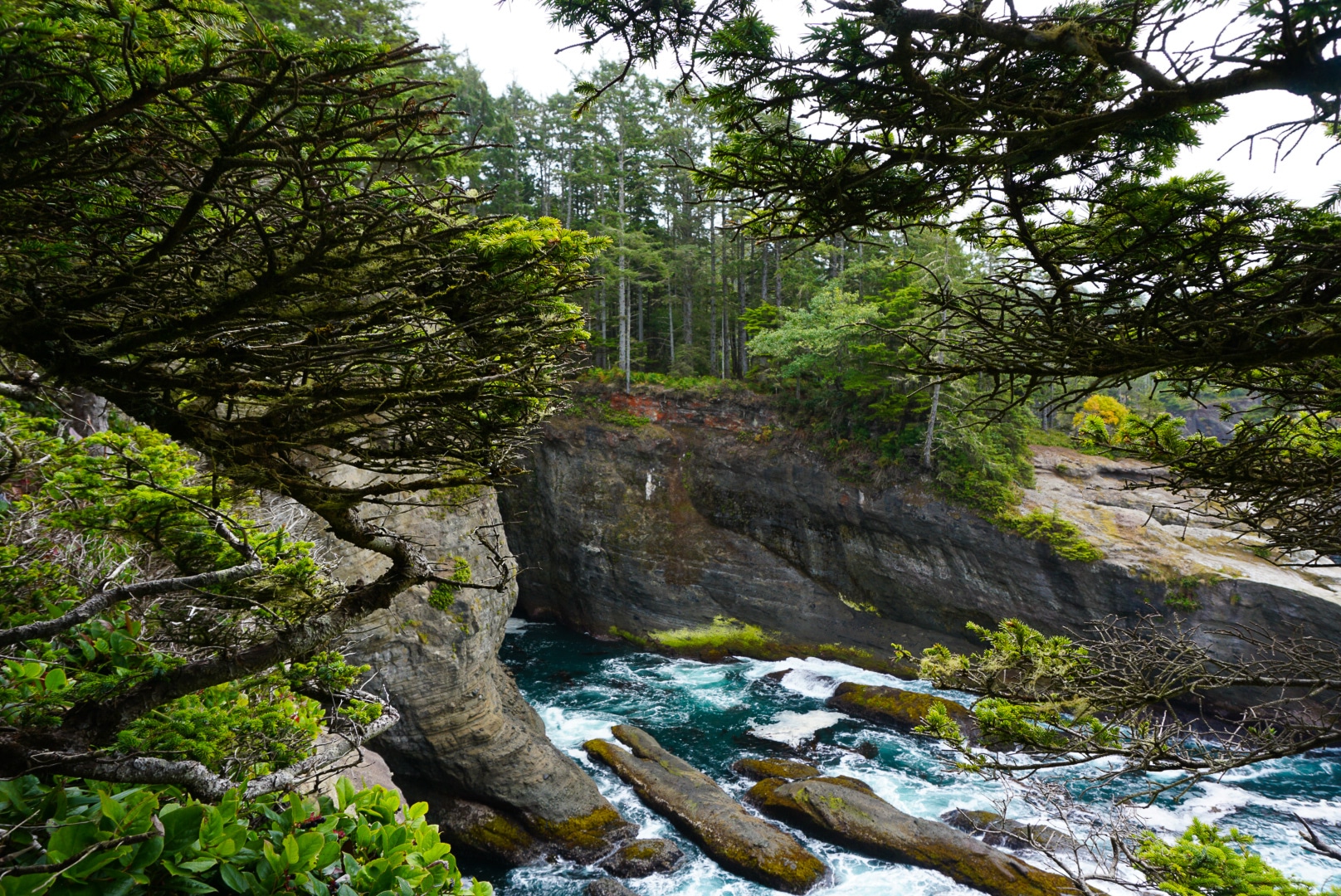
Cape Flattery

If you have it in you, one last, quick walk/hike to Cape Flattery will be worth your time. Cape Flattery is the most northern tip of the contiguous United States. While at Cape Flattery you will be sure to experience the expanse and power of the Pacific Ocean. This is also a popular whale watching spot during seasonal migration periods. 

photo by Ashley Greenwood
Cape Flattery


What is Marmot Pass?

Marmot Pass is a beautiful portal into the inner Olympic Mountain Range, for the seasoned backpacker. If you like mountain views, wildflowers, wildlife, alpine lakes and/or summits then this hike needs to be added to your Pacific Northwest backpacking bucket list.

With a consistent climb up to 6,000 feet, you are brought to the top of Marmot Pass where you find yourself surrounded by stunning views.

The hike itself is 11.5 miles round trip with a 3,489 feet of elevation gain on the way to the pass (6.25 miles from the trailhead). But don’t let this intimidate you!

The hike feels pretty consistent throughout, with one three-quarter-mile noteworthy steep section shortly after you hit the half way mark on your way up. After that, it’s smooth sailing to the pass, where several trails meet.

The hike starts out in the forest along the quiet Quilcene River, a crystal clear stream that meanders through the deep, old growth forest. After a couple miles of consistent elevation gain, you leave the river and forest behind.  Next is a leisurely stroll through a wildflower-filled meadow before heading up into the alpine.

After the meadow, trees become sparse. The next section is a rugged, alpine canyon exposure as you head up the ridge a few more miles towards the pass.

There are plenty of places to stop and rest and/or eat a snack. Once atop the pass at the junction of trails, you have options on options for further exploration. Or you can set up camp and take a nap…

Amazing views from camp.

Where to sleep?

Camping options abound around Marmot pass. You may, however, have to hike a few more minutes once reaching the pass.

If the weather is bad, and you’re looking to limit the wind exposure, there are a few meadow campsites to the hikers’ left, right before the lip of the ridge.

If the weather is nice, take a left at the junction and head up the ridge. For smaller parties there are a smattering of sites within a 100 yards left from the junction on the thin ridge.

For larger groups, you can continue your hike up the same ridge and camp in an exposed meadow. Regardless of where you are camping for the night, make sure you make it to ridge at sunset with a warm jacket and your camping drink du jour for an awe-inspiring view of the sun tucking in for the night behind rugged Olympics.

Buckhorn Mountain

Keep exploring

Once you’ve made it to the junction there are a few choices. You may continue your journey to Tubal Cain Trail, Buckhorn Lake Camp, Boulder Camp, or Dungeness Trail.

Or for shorter options, if you’d rather set up camp and settle in, you could either explore Marmot Ridge (to the left once you arrive at the junction) or casually bag a quick peak (to the right once you reach the junction).

Buckhorn Mountain looms above Marmot Pass ridge. It is just one mile and 900 vertical feet of hiking away. Marmot Pass is such a fun destination for hikers, trail runners and backpackers because the options seem limitless.

Trail toward alpine exposures. 

Tubal Cain Trail

If you have more than one night to explore Marmot Pass, Tubal Cain Trail is a excellent addition to your backpacking trip. Passing Buckhorn Lake you will be led to the old Tubal Cain mine site as well as the B-17 plane ruins. Check out the story of the crash here.

Buckhorn Mountain

Buckhorn Mountain is a steep and rewarding climb. With breathtaking views of both the Puget Sound and the surrounding mountains it is hard not to feel on top of the world. On a clear day you can catch a glimpse of Mt. Rainier, Mt. Baker, Mt. St Helens and Glacier Peak.

If Marmot Pass is your final destination and you can muster enough energy, this summit is the perfect way to end a gorgeous day of alpine hiking.

Buckhorn Mountain

En route

Once you’ve made it to Quilcene you will drive on HWY 101 south for a mile and a half, at which point you turn right onto Penny Creek Road. Continue onto Penny Creek Road for a mile and a half. Follow it left onto Big Quilcene River Road, also known as Forest Road 27. Drive on Forest Road 27 for 9.25 miles then turn left onto Forest Road 2750. The trailhead will be at the end of 4.75 miles.

A Northwest Forest Pass is required for parking and there is a pit toilet right by the trailhead.

Click for tips from REI on “How to Survive a Pit Toilet”

I’m sold. What else should I know?

At the top of Marmot Pass there will be no water source nearby. Keep this in mind while packing and planning. If you don’t plan on bringing enough for your whole trip, you will need some way to purify water. 

On the way to the pass there are some opportunities along the Quilcene River to refill an empty bottle. If you’re only doing a one night trip, it may be easier to just pack a liter or two more than usual.

It is important to be wary of wildlife as Marmot Pass will have mountain goats, bears and other critters. Keep your food a safe distance from your campsite if you do not plan on hiking in a bear canister.

There is a good chance however that your chance for a Mountain Goat sighting will be very limited, as they are being moved to the Cascade Mountain Range.

Unless you are very experienced hiking with a heavy pack in trail runners, supportive hiking boots are best for your trip to the pass and beyond. If you are just planning on a day hike or trail run, the trail is well enough maintained that trail runners or lighter hiking shoes would work just fine. There are several very rocky portions of trail once you leave the old growth.

CLICK FOR: A Guide to Shoes For an Athletic Lifestyle.

When packing for Marmot Pass don’t forget to pack warm clothes. If camping on the ridge you will be exposed to wind chill so keeping warm will be an important detail you won’t want to miss. Think Long Johns and a beanie.

CLICK FOR: A Three Layer Approach to Style This Season

Marmot Pass is a unique experience. Once you have reached your destination the journey and possibilities for adventure feel endless.

It’s an area worth exploring inside and out. Being able to look out on the Puget Sound, the Cascades, and deep into the Olympic Mountain range is a wonderful representation of what the PNW backpacking is all about.

Alpine Flowers.